Showing posts with label Jordan. Show all posts

Sunday, July 9, 2023

This street is 1,400 years old!

Like I've said before, you never know what you'll find walking through the Old City of Jerusalem, especially in the Jewish Quarter!

This time it was the Cardo, the 40-ft wide, colonnaded main street dating back to the Roman Era. It's called this because it was the main street, or the heart of the city. This is where we get words in English like, "cardio" or "cardiologist", and other words referring to heart. All ancient Roman cities had a cardo, and this was Jerusalem's (once it was rebuilt under the Romans). According to BiblePlaces, this was the main thoroughfare for Byzantine (Talmudic Era) Jerusalem. ItravelJerusalem.com says it would have stretched from the Damascus Gate to the Zion Gate, and its existence is proven by the Midba map in Jordan. In addition to shops, large churches lined the street.

Today, the street is about 6 meters (20 feet) below the current street level, showing how much the level of the Land has changed in the past 1400 years. 

The north side of the Cardo is from the Roman Era, dating back to Constantine. It has not been excavated. The south side, where we walked, is from the time of Emperor Justinian is Byzantine Era.


Part of it has been rebuilt to include shops. There's so much art lining this part of the Cardo, and it was all so beautiful! I wanted to get a piece of my own!


Along the sides of the Cardo are older remains form earlier eras... 


The older looking ruins (above) are from the 1st Temple period!

The newer ones (above right) are Hasmonian (the 400 -100 BC)

There are also places to look down and see what is directly below the cardo:


1st Temple period!


This is from the 2nd Temple Era... can you see difference in craftsmanship?


Farther down were murals on the walls lining the cardo:


And, let's not forget the areas with the original stones!


Amazing!

It was so cool, I decided to join the crowd:


*information from BiblePlaces and itraveljerusalem.com.

Sunday, March 26, 2023

Exploring the prophet Elisha's hometown

Not far from Beit She'an is another tel. This one isn't built up into a national park; there's honestly not a lot going on with it. It's just there in a field, with beautiful 360 degree views of the Jordan Valley, Mount Gilboa, and Jordan. 

It's also believed to be the hometown of Elisha.


So one particularly warm day in January, I took a metronit to a train to a bus and then walked a lot to explore Elisha's hometown.

It took a lot longer to get there than I thought it would, mostly because one bus never came and then I tried to enter the field in a way that was blocked by barbed wire and had to back track to the road. But finally, I found the right path. 

Then, I climbed up and started to explore. 

First, can we talk about the views?

To the west, to Mount Gilboa


To the east... the mountains in the distance are Jordan (at the time of Elisha, that was still Israel).


Wow! At the top there are also dirt paths like you see above. There are motorcycle and dirt-bike tracks all over them, as well as footprints and pottery shards.


Most of the tel is smooth, but one excavated part remains open:


According to BibleWalks, Rehov was likely settled at the same time as Megiddo, and likely conquered by Egypt at the same time as Megiddo. It's passively mentioned as one of Beit She'an's towns in Judges 1:27. Around the time of David, it was conquered by Israel and eventually was part of the Northern Kingdom.

Excavations in 9 areas revealed that it was a large and prosperous city. Findings of artifacts from other countries prove the residents continued to practice Canaanite/Phoenician and Syrian traditions and customs.

It was eventually destroyed by the Assyrians in the 736 BC invasion. The Assyrians lived there for a while but then moved to Megiddo. It laid in ruins for 1500 years, and then a small Jewish town was built nearby in the Roman Era. In the Middle Ages, an Arab town settled on top.

What's most interesting about this tel are the findings in the opened excavated areas:


Found in the ruins was an apiary dating back to the 10th Century BC, with the remains of dozens of beehives in clay cylinders. This is unique for many reasons:

First, the apiary was very close to a bunch of houses. This means it was likely this was a source of income for the townspeople. 

Second, signs on the property say that when they tested the apiary, the found the bees themselves didn't originate from Israel. This particular group of bees came from Turkey! Apparently, they were less aggressive and more productive than Syrian bees.

So funny! 

It gives new meaning to the phrase "land flowing with milk and honey"!

My favorite part of the day, other than the adventure and the views, was going back from the tel and finding the local springs right beside it. Even though it was January, it was close to 80 degrees that day and I was hot! I waded in and cooled off before heading to the bus stop.

Definitely a great adventure!

Sunday, January 22, 2023

Hiking in the Wilderness of Zin

It's not everyday that after you go hiking, you hear, "Yeah, we're currently in the Wilderness of Zin. This is part of where the Israelites wandered for 40 years."

Wow!


The last part of my Christmas/Hanukah 2022 adventure included a close hike from Tamar Park. The desert here is so interesting because it is red (hence "Edom", which means "red" in Hebrew), there are these crazy formations everywhere. I'm not exactly sure what I pictured the Israelites wandering in, but I think I pictured it flatter, definitely.

As for its 'red' nature, that didn't throw me (though it was cool to be in the land of Esau!). As any good Georgia girl knows, dirt is red. What other color would it be?


So, the hike was fun. We went around this hill, into a canyon inside it, and then up.


Did I mention that I'm afraid of heights? And Israel's trails, unlike the ones in the US, do not have handrails or metal lines to break a fall. That's something I haven't gotten used to here yet. Thankfully, I was with kind friends who encouraged me (especially on the way down)!

The view from the top was worth it:


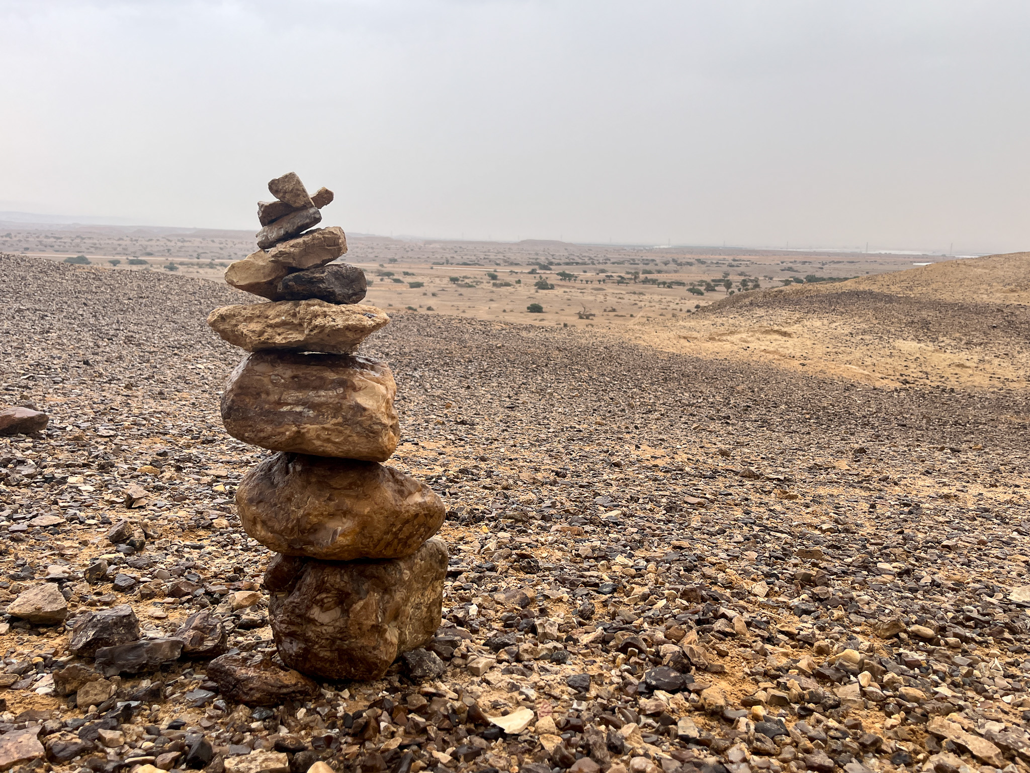
The below tower has 12 stones. It's for the 12 tribes of Israel!


Amazing! What wasn't amazing was the rain that started once we all got there. Actually... any time it rains in the desert it is amazing. It just made the descent more scary, though we went down before it got too slick.

My friend also pointed out something I'd never thought of. I'm a very literal thinking, so when I read that the Israelites followed a cloud, I picture them walking behind one. But it likely covered them, giving shade in the sweltering sun. Can you imagine not only wandering in the wilderness for 40 years, seeing the same places over and over, your clothes and sandals not wearing out, and being blessed in the shade even while being disciplined for lack of faith? I imagine the pillar of fire also kept them warm on cold desert nights. I think even wandering in a desert that had interesting, varied topography and wasn't unendingly straight was also a grace, because a person could go mad plodding on and on without anything new to look at. 

Now that I've had a peek of the Wilderness of Zin, it's so much easier to picture!
And, last night in my devotions, I read Exodus 16, where God first sent the manna and quail. Guess where that was? Yup- you got it right- the wilderness of Zin!

Tuesday, December 27, 2022

Did the Magi stop here on the way to Bethlehem?

From where—and through where—did the wise men travel?


I've never really thought too much about this, although I heard once that they travelled through Petra (modern day Jordan) on their way to Bethlehem. So when I planned a trip over Christmas weekend to the Negev desert, which is south of Be'er Sheva, and therefore south of the boundaries of ancient Israel, I didn't expect to see any Biblical places, let alone find a Christmas connection.


While watching googlemaps on the bus south of Be'er Sheva to Mitspe Ramon, I saw Avdat National Park on the map. Then I saw it was originally settled by the Nabateans, the same people who lived in Petra. So then I knew I had to go.


The name "Nabatean" means "Cistern digger" in Aramaic, and their kingdom included northern Arabia, Edom (Judean Desert), Moab (Jordan), Hauran, the Negev, and Sinai. Their caravans of 10-20 camels carried spices, incense, medicinal plants, textiles, dyes, silver, and gold. Each camel carried 150-200 kilos (330-440lbs), and their handler walked before them.

The route was over 1800 kilometers (1120 miles!) in the desert—a 65-day trek. Along the way were stations where the caravans could rest, replenish provisions, and trade out camels.


It turns out that Avdat was station number 62 on the ancient Incense Route (Spice Route) from 300 BC- 300 AD that went from Yemen to Gaza, passing through Petra. So if the wise men did travel through Petra and then north to Bethlehem, they would have passed by Avdat. Maybe they even stopped there briefly! 

Could the star have been visible from here?


As with all ancient roadways, they have become modern roads. So, the highway that passes Advat is likely the Spice Route. 


After Nabatean King Rabbel II died in 106 AD, the Nabatean kingdom was annexed to the Roman Empire, who then built onto the area. After them came the Byzantines. So, on top of this tel is a WEALTH of archeological structures, not to mention the view!

We had less than 90 minutes to explore the whole structure, which was almost impossible. But we made it by just skipping a few areas that were less interesting to us. You can basically picture me running up the mountain, camera in hand determined to explore the entire tel. It was so much fun! 

So, here's part of my self-tour of Avdat, starting with a home from Roman times:

LOVE all these arches!


(a lot of wine was made here... they found 14 winepresses!)


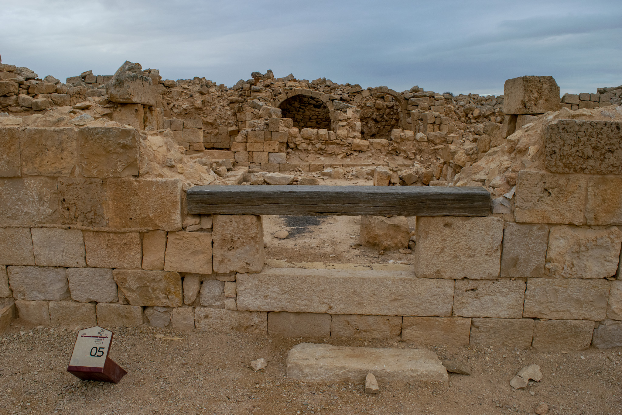
The main complex at the top is HUGE! There were 2 Nabatean temples and 2 Byzantine churches (one was a monastery)... and it was all attached to a Roman fortress!


the entire complex from below (photos above and below)


Nabatean temple
just part of the view!

One of the Byzantine-era churches (the other was a monastery) and has graves with Greek-inscribed grave stones in it. Christianity came to the region during the Byzantine period, and it became the official religion. The remaining Nabateans accepted the new faith and replaced their script with Greek. 
Another Nabatean temple


Peek-a-boo!
I mean, this view!


Then, onto the Roman Fortress, which had a tower where you could view the entire complex:


In the photo above, the closer ruins are Nabatean, the farther ones (top right) are from the Roman army camp.

When you leave the fortress, immediately in front of you is a massive wine press and the remains of the Byzantine settlement, which was destroyed in a massive earthquake. Throughout the route through the 'neighborhood' there are some excavations and neat finds (apparently, somewhere in there is a Nabatean pottery shop):


Love the double arches below! #mcdonalds?


Then, you exit by the southern Roman tower (which, at the time I thought was locked, but 2 pictures above have people on top of it, so that was a missed opportunity):


Finally, you walk past the caravan (pictured above), and see one more Roman villa:


Talk about incredible! I love a room with a view!


And what a view it is!


The view towards the main part of the tel:


We made it down just as the park was closing, and while we waited for the bus, got to see the sun set (It sets at 4:30pm in the winter):


What an amazing adventure, which was extra-special because of exploring this place on Christmas day!

What did you think of it? What do you know about the wise men?

By the way, I hope you had a Merry Christmas and have a wonderful New Year! See you then!