Showing posts with label Kursi National Park. Show all posts

Sunday, November 13, 2022

The Golan: Peace Vista (Part 3 of 4)

Driving south along the Golan, past the entrance to Gamla National Park and you'll find the Kfar Haruv Kibbutz and one of the most spectacular views of the Sea of Galilee that I've never seen: The Peace Vista.


It was windy that day we were up here, but I was so glad for that because it was late June and a documented 103 degrees Fahrenheit. The view did not disappoint!


It was so vast (and we were so close) that I couldn't fit the whole lake in the photo. WOW! 


Built on the stones of a 1,700 Talmudic village, the view point offers and incredible view to not only appreciate the beauty of the area but also to understand its history. From above, you can see much of the Golan. And if you're with a tour guide like I was, from there, you get to get about the history of the area, most recently in the Six Day War of 1967, with him pointing to and fro.

And, there was a bonus. It's hard to tell unless you zoom in, but beyond the taller trees on the mid-right of the photo is a ridge and some more ruins: Susita (Hippos)! You can almost see Kursi National Park as well. So cool!

Shalom for Israel, Shalom for Jerusalem, Shalom for all.

Sunday, February 6, 2022

Hippos took my breath away

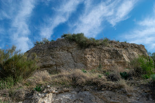
After Jesus sent the demons into the pigs in the Galilee in Mark 5, He told the formerly demon-possessed man to go far away instead of going home. This is because the people who lived nearby were afraid and angry. Mark says that the man went to the Decapolis, which I assumed was Beit She'an. When I went to Kursi National Park and saw the cliff, I was confused because Beit She'an is more than 30 minutes away by car. That's a long way to walk!

But, the Decapolis was a series of 10 cities under Roman control in Jordan, Syria, and Israel. And not too far from the cliff are the ruins of Hippos, another one of the Decapolis. 

So, when I learned this, and that it wasn't yet a national park, I had to go!

First of all, the drive there is AMAZING!!!!! The Galilee is beautiful, and has turned so green from the winter rains! It was a clear day, and before the wind came through, the lake was like glass. So as we started driving up to what will be Susita National Park, the views took my breath away.


Can you see the reflection of Tiberias in the water?


Hippos, which means "horse" in Greek, was founded by the Seleucids in the inter-Testamental period.It was given to Herod the Great in 27 BC and then returned to Syria in 4 BC. In 135 AD, when the Romans put down the Jewish revolt and renamed the land of Israel as Syria-Palestina, Hippos enjoyed great prosperity. There was a theater, an aqueduct that brought water from the Golan Heights, and later, a basilica.


Around 4th Century AD, the Byzantines came to Hippos and at least 1 bishop was seated there. Three hundred years later, Muslim armies captured it in their conquest but allowed the citizens to still practice Christianity. 

In 749 AD, an earthquake destroyed it and the city was abandoned.


Like I said, this is on its way to being a national park, but it isn't yet. So there wasn't information for what I saw when I walked through... but it was fascinating even without that! And it just means I'll need to go back when the national park is opened. If you're in the Galilee, it's worth seeing, even before it becomes an official park. Put Hippos, Susita National Park, on your map!


Sunday, January 30, 2022

Where Jesus sent the demons into the pigs

When I saw Kursi National Park on Google Maps while I was in the Galilee, I thought it just had some cool ruins of an old church. I didn't think it was a Biblical site.


And to be fair, these ruins really are cool, mostly because I love arches. And some of the original floors from this church from the 5th century. 


I mean, who doesn't love original floors?


But what I didn't realize until I started exploring is that this national park is in the Gerasenes, where, in Mark 5:1-20, Jesus healed the demoniac and sent the demons into the herd of pigs, who then ran over the cliff. 

The freed man then went into the area of the Decapolis to tell of what Jesus had done). I checked googlemaps, and Beit She'an is actually pretty far from there...almost 40 minutes driving. But Mark's account speaks of the local people being angry and afraid, telling Jesus to leave the area, and Jesus telling the man to go far away. So maybe he went to the city of the Decapolis that is at the foot of Beit She'an. It's also likely he went to Susita (Hippos), which was also one of the 10 cities of the Decapolis. That is closer to Kursi National Park, and I hope to go there soon).

Either way, this is the traditional location of that cliff! 


As I've said before, the Sea of Galilee has shrunk a lot over the years. Right now it's about 13 miles long and 7 miles wide at its widest point. There's actually a trail that goes up from the left to just before the actual cliff face, and the remains of an old chapel are there as well.

The cliff from directly below it:
The location of the water makes it reasonable to think that it could have touched the edge of this mountain, as the Sea of Galilee has shrunk a lot since the first century.


So fun!!!